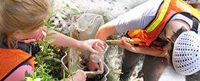
This three-year project will engage 1,275 students and 30 high school teachers with professional scientists in research regarding the changing nature of the snowpack across Maine, emphasizing the coastal climate zone where snowmelt provides cues for diadromous fish migration and changes in flood flows. The principal benefit from participating scientists’ perspectives will be the collection of data regarding the character and duration of snowpack in different locations and types of watersheds over a larger number of sites than are currently monitored, including sites distributed across all three Maine climate divisions (Coastal, Southern Interior, and Northern). Students and teachers can collect data across many more sites than scientists can easily sample without student assistance. Data will be used to expand the number and the geographic scope of existing monitoring programs. The creation of an ongoing field-based snowpack monitoring program will bring students into regular contact with working scientists and has the potential to continue year after year. Electronic infrastructure can support increasing numbers of teachers and students in the program through time.
A principal project objective is to show students that watersheds are interconnected systems comprised of physical factors and living things, and that observable effects of short-term variability in weather and long-term trends in climate change in one part of the system can have surprising and unanticipated effects on other parts of the system. In pursuing this objective, the program will build on the first B-WET project, which focused on watershed connectivity through student research on watershed food webs, movement of diadromous fish, and the effects of culverts on fish habitat. This new project will couple students’ snowpack and weather data collection with information about streamflow to facilitate student thinking about both flood flows and fish migration. Diadromous fish rely on various cues when migrating into freshwater streams in the spring, including length of daylight, water temperature, and streamflow rates. A primary concern for fisheries scientists and managers is a gradual decoupling of these signals due to climate change, leading to asynchrony in cues. This project will compile new data and integrate these data with existing information to provide information on the relationship between snowpack and other environmental variables within some of Maine’s prominent watersheds.
The lead institution for this partnership is UMaine, other partners in this research are Maine Sea Grant, NOAA National Weather Service, the US Geological Survey, the Maine RiSE Center, and Acadia National Park.

 Acadia Learning brings scientists, teachers, and students together in partnerships that result in useful research and effective science education.